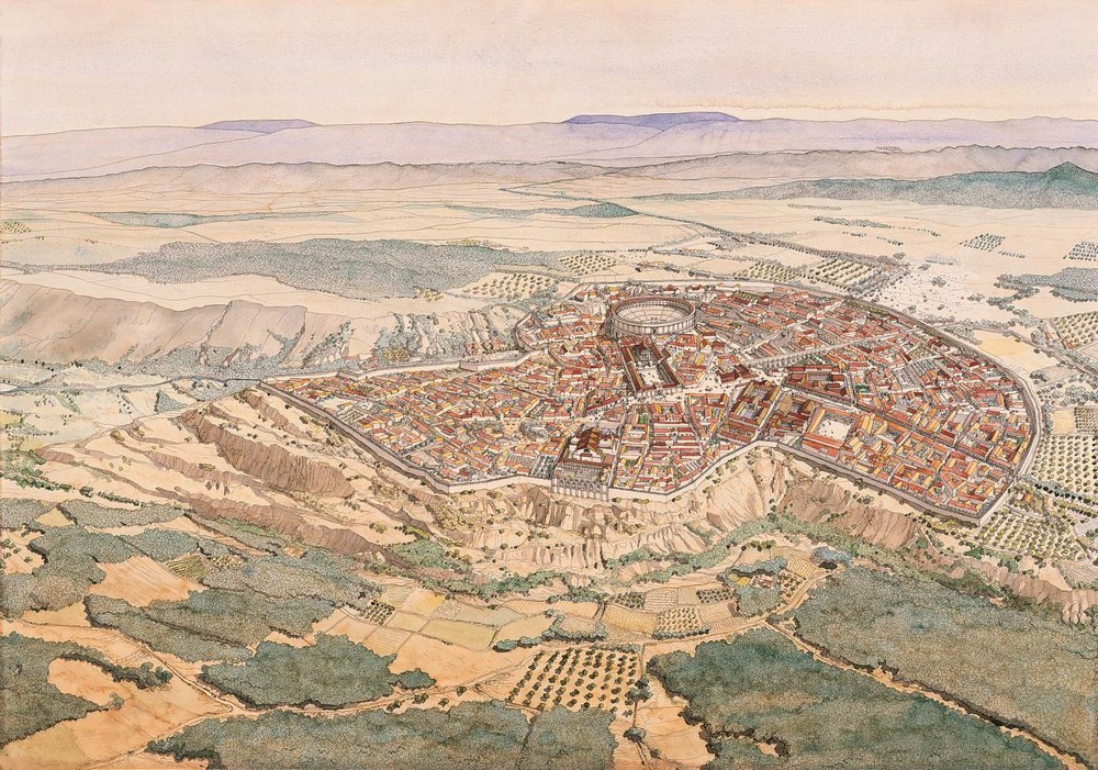
The excavated areas of Conimbriga are generally set in the centre of the ancient city. On the access to the Ruins, visitors cross a flat area that the Romans added to the pre-Roman village that they found already existing in the 1st century BC. The large residences that make up the greater part of the area that can be visited are located surrounding the meeting point of the three main road axes. The area of monuments is located close to the centre of the plateau that the city has always occupied.
The road network of Conimbriga is based on a fundamentally triangular structure dictated by the topographical conditions of the plateau and by the three axes that configure the area in these conditions: the main axis of the village that previously existed when the Romans occupied the region and the two axes of the Roman road that were incorporated into the city, one that went in the direction to Sellium (Tomar), the other to Aeminium (Coimbra). From early on, the buildings constructed facing these roads had porticos in front of them that went along the entire length of the street, at least in its main section. The stone paving of the roads in the central area dates from the Flavian period.


Conimbriga visualization test in the 19th century. II D.C. ©Jean-Claude Golvin
O Museu Monográfico de Conimbriga – Museu Nacional e a Editora Bluebook, colocam à sua disposição esta parte do catálogo das coleções para sua comodidade na visita a Conimbriga. A sua reprodução por qualquer meio não pode ser autorizada e constitui violação da Lei. Pode adquirir o Catálogo das Coleções na loja do Museu.
O site e a informação digital disponibilizada por QR-Codes estão em fase experimental. Agradecemos a sua compreensão e colaboração.


